
THE SKEENA: Riding the Rails Across British Columbia
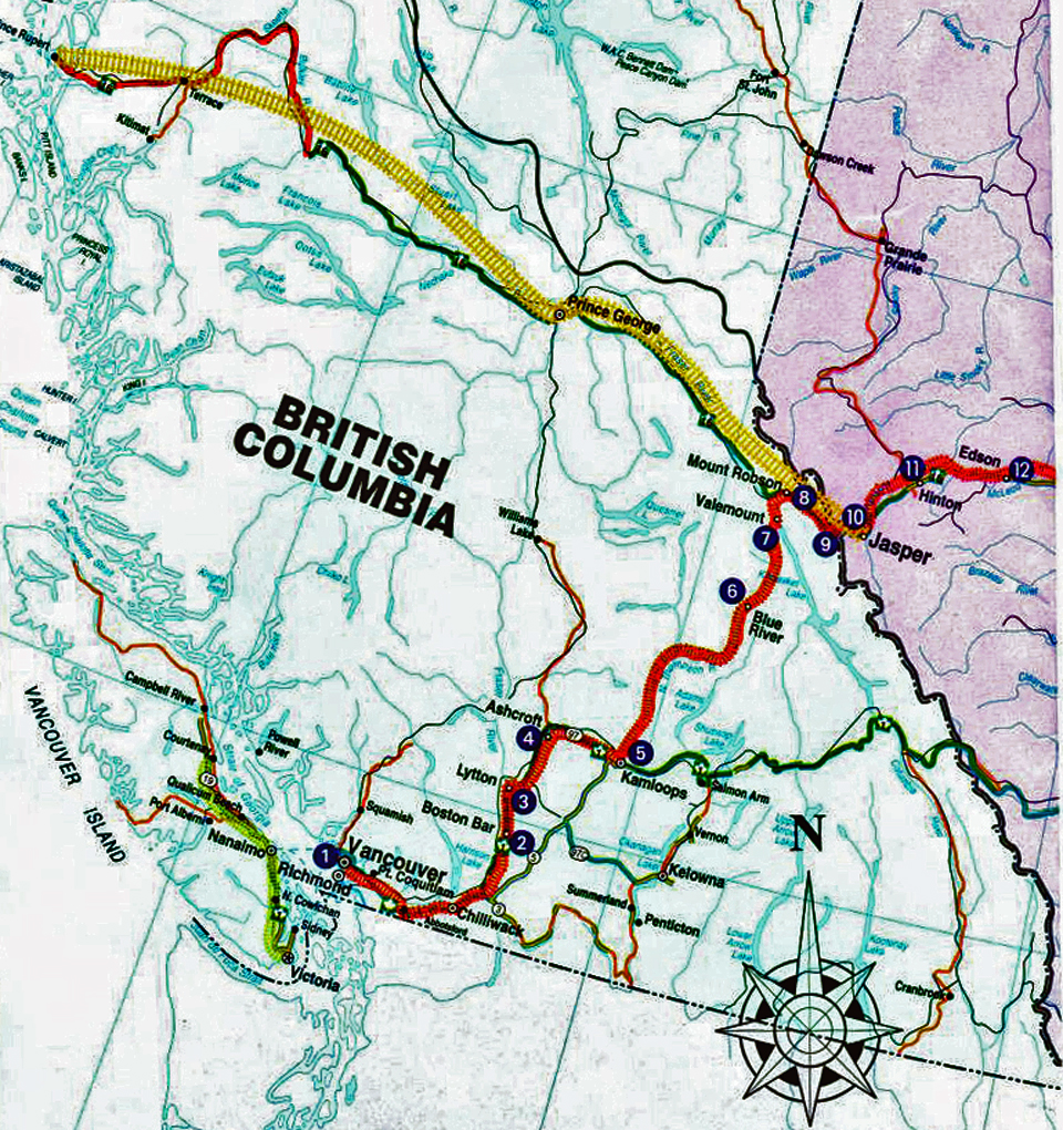
We began by riding VIA Rail’s Canadian from Vancouver, British Columbia, to Jasper, Alberta, for a stay in the heart of the Canadian Rockies. Now we were continuing northwest with VIA Rail’s Skeena route from Jasper to Prince Rupert, British Columbia.
With our bags checked at the Jasper station, we enjoyed a leisurely breakfast with locals at Bear’s Paw Bakery across the street. There was time to walk part of the Jasper Discovery Trail that runs about 5 miles along the perimeter of town and to pop into an Internet café before boarding the Skeena.
About the railway
Canada’s Transcontinental Railway spans 4000 miles. Only the Trans-Siberian Railway is longer. We were about to experience the second of its two scenic segments between Jasper and the Pacific coast.
The Crown Colony of British Columbia agreed to join the Dominion of Canada in 1871 on the condition of being linked by rail to the rest of the country. The push was on for westward expansion, and in some places competing railways ran tracks side-by-side.
Did you know? During World War I, the government tore up duplicate rails and sent them to France.
Government assistance was offered for a second transcontinental railway. Charles Melville Hays, president of the Grand Trunk Pacific Railways, received support for his line to this port and planned to link travel and trade by rail and sea all the way from Europe to Asia. Unfortunately, his return passage from a director’s meeting in England was booked on the maiden voyage of the Titanic. The railway to Prince Rupert was completed, but he and his grand transoceanic plans went down with the ship in 1912.
Canadian National Railway is an amalgamation of the early Canadian railways. It has expanded into the US, and focuses on freight transport. Bill Gates is a major shareholder. In 1978 VIA Rail took over the passenger service and pays rent by car and miles.
The Skeena
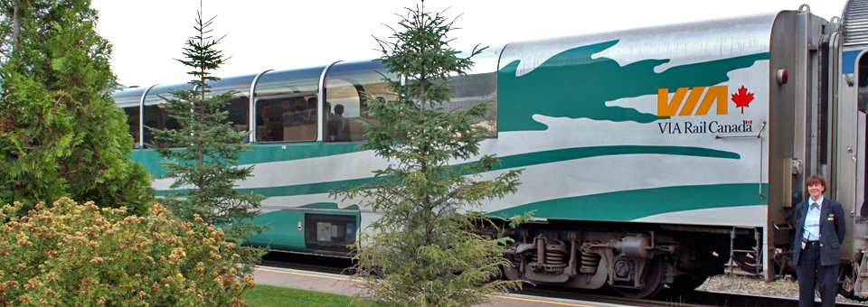
Once we were settled in our seats it was “Trays down, forks up!” the mealtime refrain of our fun-loving attendants. We had opted for Totem Deluxe class on the Skeena, an all-inclusive service available from mid-May to mid-October. Like the Silver and Blue service on the Canadian, it includes regional cuisine and access to the Park Car.
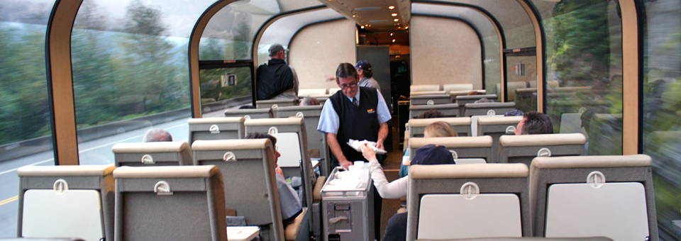
Instead of sleeping compartments and a dining car service, however, the Skeena’s meals are served at your reserved seat in a glass-enclosed Panorama car. Arrangements for overnight accommodations in Prince George are made on your own.
The elevated glass observation dome of the stainless steel Park Car is the best place on the train for spotting wildlife. Each Park Car’s mural lounge has scenes by a Canadian artist of the national park for which it was named.
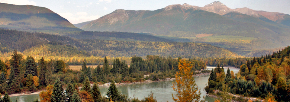
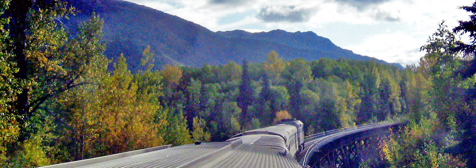
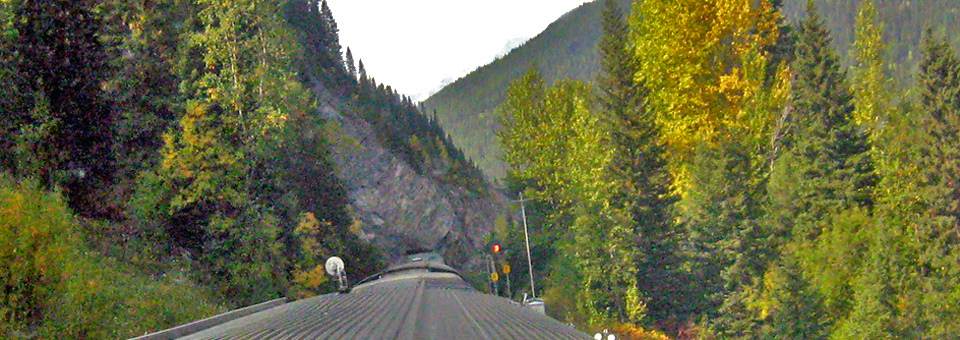
On our two-day 725 mile daylight land cruise we sat back in our glass carriage and enjoyed the view. We experienced the enormity of mountains and vastness of the Interior Plateau and a forested wilderness from the comfort of our armchairs.
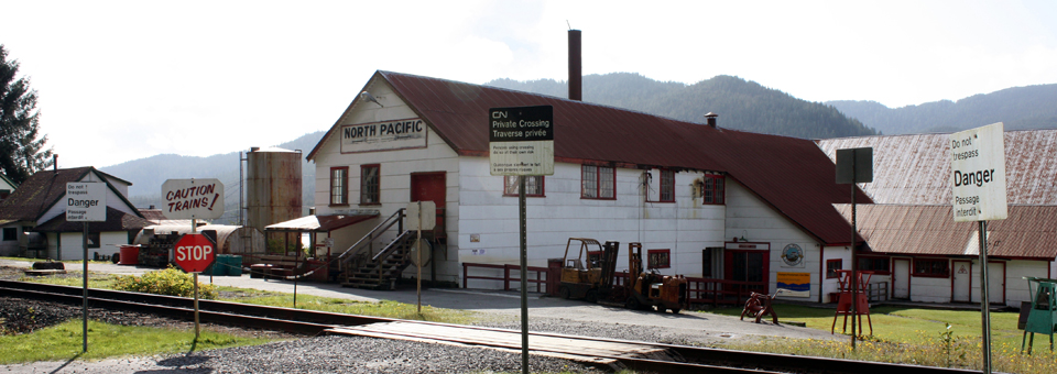
We disembarked at a few historic stations like the one at McBride, settled during construction of the Grand Trunk Railway and named for Canada’s youngest Prime Minister. The train drops off mail at remote settlements like Penny, population 7, once a busy sawmill town with its own Grand Trunk Railway station. A lone gold prospector signaled to board another car at a remote flag stop and we paused a few times to avoid hitting bears on or near the track.
Points of interest included Yellowhead Pass, the mountain pass across the Continental Divide. Fort Fraser, near the fur trading post established by Simon Fraser, and the nearby mile 93.3, where the spike completing the Grand Trunk Railway was driven on
April 7, 1914.

Totem poles marked First Nations settlements, and a few folks caught a passing glimpse of the world’s largest fly fishing rod in a town named Houston, site of the world’s largest sawmill.
Railroad 101
Informal talks on the workings of the railroad added to the excitement of our adventure. We were able to track our itinerary and decipher sights, sounds, and signals.
Although Canada adopted the metric system, the railroad kept the original mile markers. Subdivisions up to 146 miles long begin in Halifax, Nova Scotia, and were set by the distance a steam train could travel before refueling. Numbers increase from east to west and reset at each subdivision.
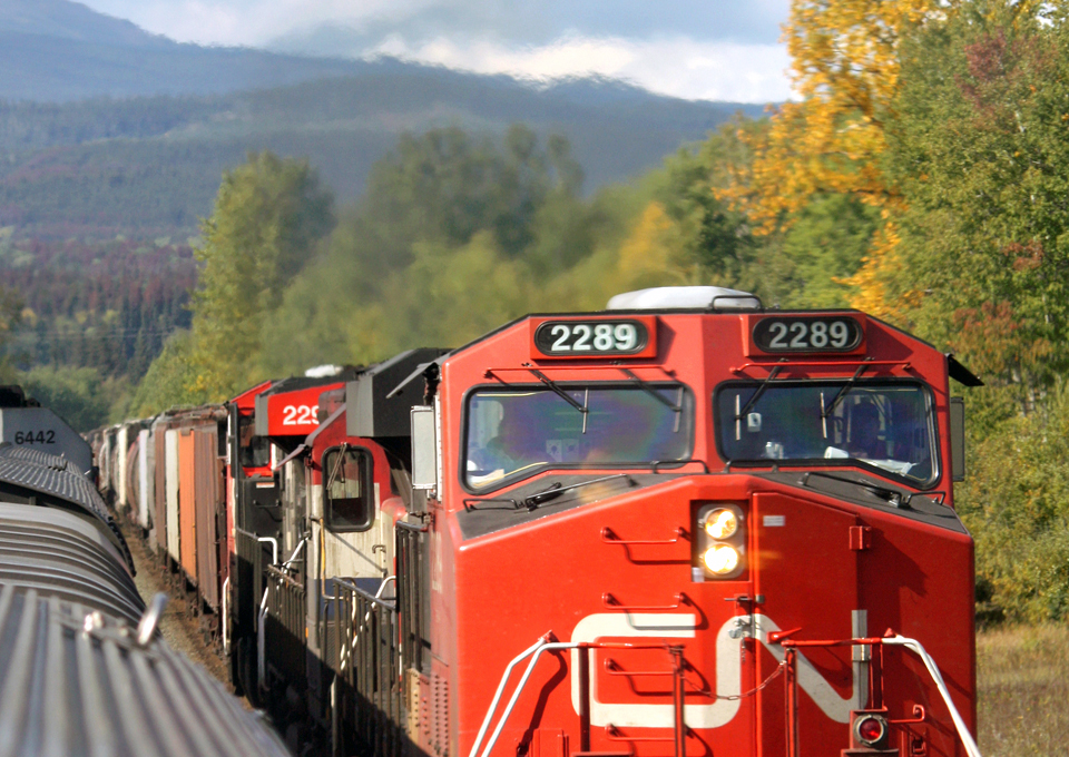
Seemingly endless eastbound freight trains whooshed by, laden with British Columbia’s coal, grain, and lumber. Diamond shaped signs indicate speed limits, lower for freight trains, which can weigh as much as 14,000 tons and take longer to stop.
A large “W” on a signpost meant the engineer would be sounding the whistle. We learned to listen for the distinct combination of long and short blasts that signaled our approach to and departure from a station or crossing.
These talks described how tracks are heated in freezing weather and potential problems are detected with state-of-the-art technology that includes fiber optics, automated switches, sensors, and laser beams, making trains the world’s safest form of travel.
Prince George
The Skeena stops overnight in Prince George, Northern British Columbia’s largest city, an important manufacturing and service center known for its forest industry, sawmills, pulp mills, and oil refinery.
Athletic teams participating in the 2010 Vancouver Winter Olympics will train at the recently completed $52 million world-class sports center at the University of North British Columbia.
The east-west Yellowhead Highway 16 and north-south 97 (known to the north as the Alaska Highway) meet at this hub. The fur trading post Fort George was established here, where the Fraser and Nechako Rivers meet.
The train arrives after dinner and leaves early in the morning. If you have the time, plan to rent a car and extend your stay. Trains run 3 or 4 times a week.
There is outdoor recreation in the parks as well as local art at Two Rivers or the First Nations Art Gallery. Places of interest include the Fraser-Fort George Regional Museum on the site of the original Hudson’s Bay trading post, the Railway and Forestry Museum, and the Exploration Place Science Center.
Huble Homestead, north of town, is a living heritage community built by a family in the paddle-wheeler business. The 5-mile trail known as Giscome Portage, a wagon road during the Gold Rush, originates here and crosses the Continental Divide.
Ask at the Visitor Center in the depot about a self-guided forestry tour or free tours of local pulp mills. Saturday morning’s Farmer’s Market has live entertainment.
With a week or two to spare, you could drive north to the Yukon on the Alaska Highway. This area is known as the Serengeti of North America for its abundant wildlife.
On the rails again…
Back on the Skeena, we rode through vast farmlands and passed towering trees. Our sunny day turned misty as we approached the lush temperate rain forest. Skeena is a First Nations word for “water of the clouds” or “river of mists”, a name that matched the conditions.
Ecosystems like this one between the ocean and coastal mountains of the Pacific Northwest are rarer and produce more biomass than their tropical counterparts. As in Northern California’s Redwood forests, the mild climate and abundance of rain and fog protects against forest fires. Trees flourish and have been known to live for as long as 1500 years.
Some of these trees are harvested for use as utility poles. Others are carved into totem poles, like the ones we passed in First Nations towns like Kitwanga, “land of rabbits”.
Prince Rupert
Our scenic rail tour ended in the port city of Prince Rupert, named for the son of Queen Elizabeth and Frederick of Bohemia. Rupert was governor of the Hudson’s Bay Company, once the world’s largest landowner, controller of North America’s lucrative fur trade, and Canada’s largest fur trader today. This flourishing fishing and forestry community of about 13,000 residents is now the second largest city on British Columbia’s coast.
Archaeologists believe that about 25,000 years ago hunter-nomads in search of wooly mammoths crossed the land bridge connecting Siberia and Alaska that is now the Bering Strait. Artifacts reveal that Tsimshian Nations lived here for over 10,000 years, making this one of the oldest continuously occupied regions of the world.
This City of Rainbows surrounded by mountains and fjords is in the heart of the North Coast’s temperate rainforest. Sheltered by islands of the Inside Passage, it has one of the deepest ice free natural harbors in the world. Little wonder this was one of the most densely populated areas in North America when European explorers “discovered” it.
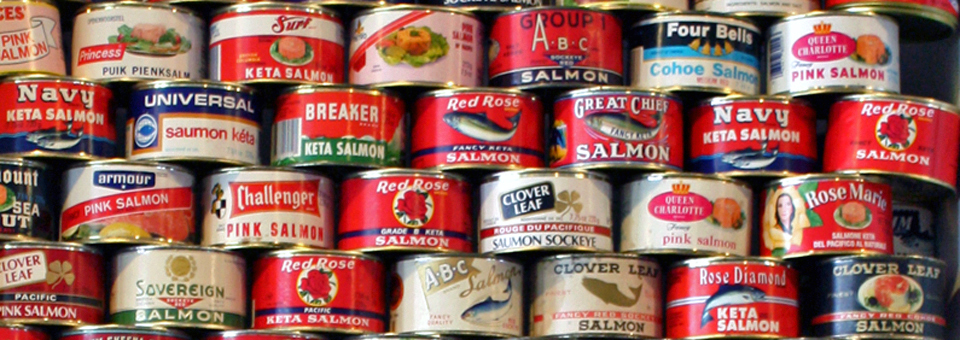
By the mid-1800s maritime explorers lured by the lucrative fur trade set up trading posts. Pioneers followed, and soon there were steamships and paddle wheelers. With abundant salmon in the Skeena and Nass Rivers, canneries soon became an important industry.
Since the port offers the shortest shipping route to Asia, the only American military base on Canadian soil was located here. It was a staging area during World War II for thousands of Canadian and American troops and supplies en route to the Aleutians and other parts of the Pacific. The Skeena Highway was built for national defense.
Well-connected Prince Rupert is the western end of Trans-Canada (Yellowhead) Highway 16. VIA Rail’s depot also serves the northbound Alaska Marine Highway and southbound BC Ferries. The multi-million dollar container and cruise ship terminal welcomes over 110,000 cruise ship passengers annually. Seaplanes service villages and tourists.
Highlights of Prince Rupert
Be sure to allow enough time to experience the uniqueness of this area.
Guided tours are given of the canning lines and original buildings, including the store, living quarters, and mess house of this self-contained ethnically diverse company community.
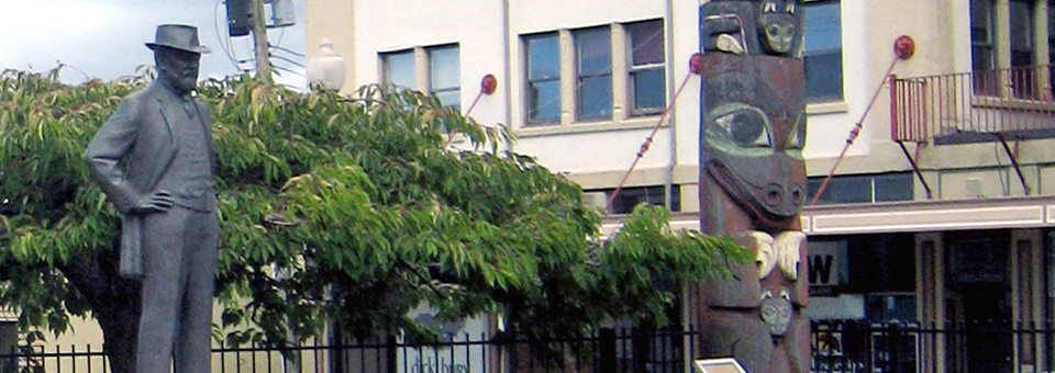
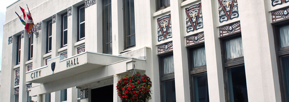
Pioneer buildings in the Historic Downtown Shopping District are much as they were in the boom town days. Totem poles and a statue of town founder Charles Melville Hayes stand next to a City Hall adorned with First Nations designs.
Prince Rupert has been known as the Halibut Capital of the World and it is renowned for some of the world’s best sport fishing.
This Gateway to the Wilderness is where eagles, bears, and whales outnumber people. There are a number of highly acclaimed whale watches and eagle feeding excursions. Flight-seeing tours offer a bird’s eye view of fjords and glaciers.
Just 26 miles from the border, Prince Rupert is also known as the Gateway to Alaska.
The Khutzeymateen Grizzly Bear Sanctuary is unique in North America. Khutzeymateen, Tsimshian for sheltered place of fish and bears, is run jointly by the province and Tsimshian Nation. It is accessible only by boat or seaplane, and visits to the protected estuary are by authorized guided tour only. Grizzlies, which grow up to 8.8’ high and 800 pounds, are Canada’s largest carnivore. Boats glide quietly close to shore where the grizzlies feed. The best time to visit is early May to early July.
This mountainous and protected region is great for spotting porpoises, orcas, humpbacks, eagles, and mountain goats. If you are lucky you may spot a rare white Kermode, also known as the “Spirit Bear”.
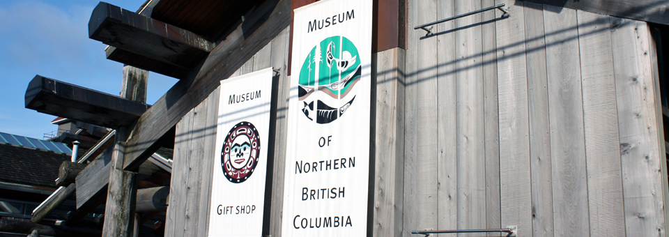
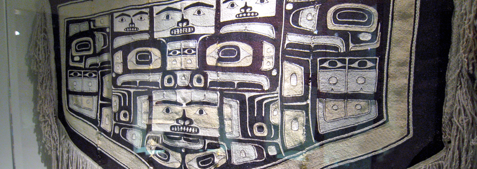
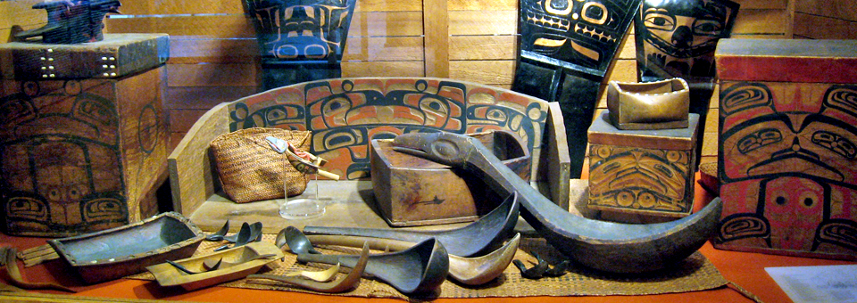
A longhouse-style building of massive cedar timbers houses the Museum of Northern British Columbia, a showcase of First Nations archaeological artifacts and ceremonial art.
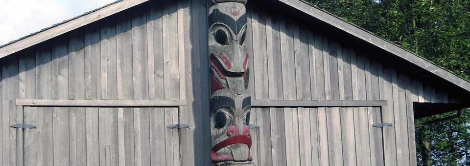
Tsimshian, Haida, Nisga’a and Tlingit artists work in the nearby Carving Shed creating traditional totem poles that depict birds and other creatures from religious legends.
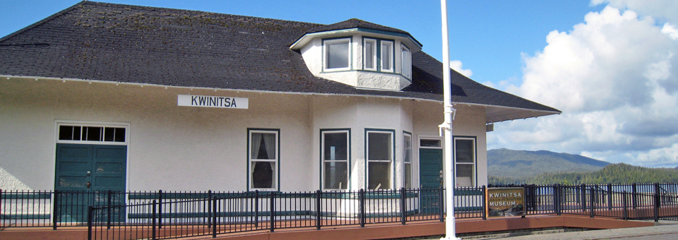
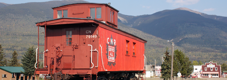
Kwinitsa Railway Station Museum in Prince Rupert’s Waterfront Park exhibits Canada’s northern railway history in one of the last of the original Grand Trunk Railway stations.
The Millennium Walkway extends along the shore between this park and Cow Bay.
The reversing waters known as Butze Rapids rival the spectacle created in St. John, New Brunswick, where the world’s highest tides flow into the Bay of Fundy. A trail off Route 16 leads to a popular viewing point.
Some of the best seafood in the province is found in Prince Rupert, most notably halibut and Dungeness crab. Cow Bay Café is popular with locals and is in a trendy shopping district with boutiques, restaurants, an artists’ cooperative, and the visitor center. Cow Bay was named for the herd of cattle that had to swim ashore to a dairy that opened here in 1909. The dairy is gone, but the name remains.
From land to sea
Our rail adventure left us with a heightened awareness of the extraordinary nature and history of this landscape and we had minimized our carbon footprint in these pristine regions. VIA Rail’s fuel consumption has been reduced by 25% since 1990. According to VIA Destinations Magazine Aug/Sept 2008, train travel is one of the most efficient with regard to greenhouse gases.
Soon our adventure would continue by sea with a day-long cruise of the spectacular Inside Passage. We would travel by coach through Vancouver Island to capital city Victoria and by ferry back to Vancouver.